
Topographical & PAS128 Utility Survey at Ewood Park, Blackburn
Location: Blackburn, Lancashire
Survey Type: Topographical Survey + PAS128 Utility Survey
We were instructed to undertake a comprehensive survey of the stadium and surrounding areas, delivering accurate, design-ready information for the project team.
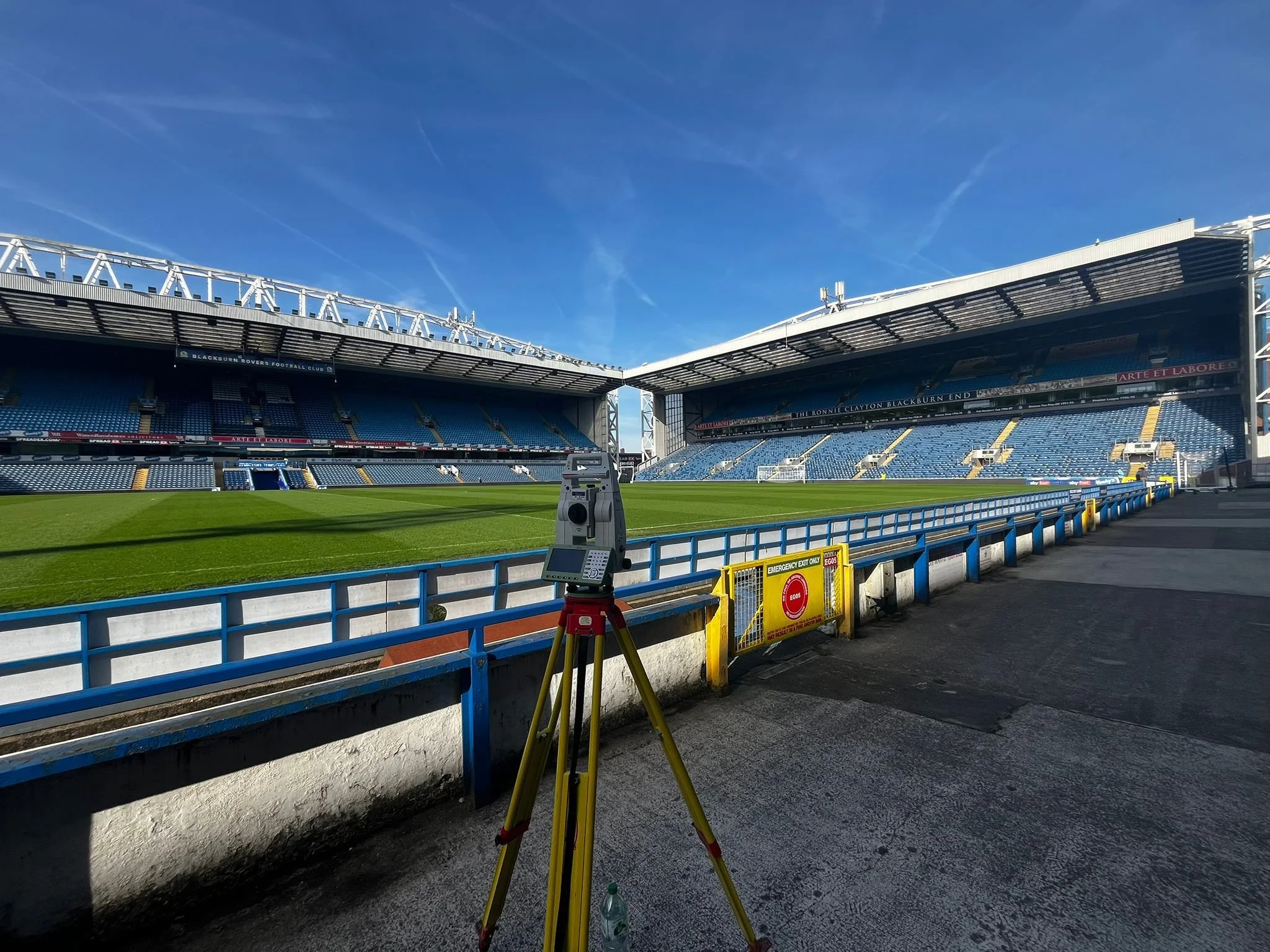
A detailed topographical and PAS128 utility survey of Ewood Park, home of Blackburn Rovers, carried out to support ongoing development and planning works.
This project required precision, careful planning, and efficient execution within a live stadium environment.
Scope of Works
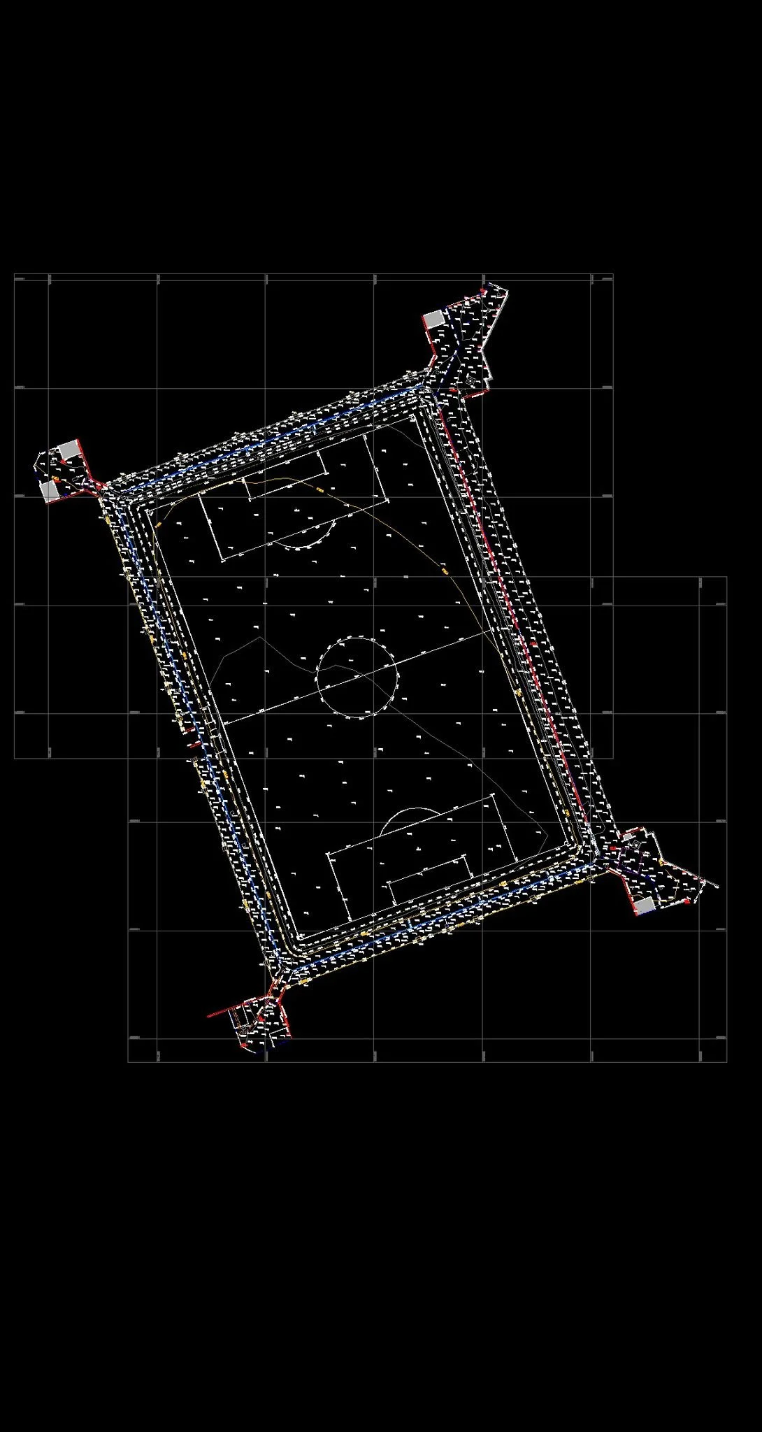
Full topographical survey of external areas
Detailed feature capture (buildings, levels, access routes, structures)
Establishment of a robust control network
PAS128-compliant utility survey
Integration of survey and utility data into a unified output
Challenges
Working within a stadium environment presents a unique set of challenges.
Access had to be carefully managed around operational areas, with constant consideration given to safety, movement, and minimising disruption. The scale and complexity of the site also required a structured approach to ensure no loss of accuracy across large extents.
In addition, integrating utility data in line with PAS128 standards required coordination and attention to detail to ensure consistency across all datasets.
Our Approach
As with all our projects, the focus was placed on control, methodology, and quality of output.
A high-accuracy control network was established across the site to ensure consistency throughout the survey. From there, data capture was carried out using Leica survey equipment, allowing for efficient and reliable collection of both topographical and utility information.
Careful planning of instrument setups ensured full site coverage, even within constrained or sensitive areas. Throughout the process, ongoing checks were carried out to maintain accuracy and integrity of the data.
Post-processing was approached with the same level of attention, ensuring the final drawings were structured, clean, and easy to interpret.
Deliverables
The final deliverables included:
Fully layered and structured DWG drawing
PDF issue set for ease of review
Integrated topographical and PAS128 utility survey data
Clear, design-ready outputs suitable for architects, engineers, and contractors
All information was presented in a way that allows both technical and non-technical stakeholders to understand the site with confidence.
Outcome
The completed survey provided the project team with a clear and accurate representation of existing site conditions, reducing uncertainty at design stage and supporting efficient progression of the works.
By combining topographical and utility data into a single coordinated output, the risk of clashes and redesign was significantly reduced.
At Brookes Geospatial, we place a strong emphasis on delivering surveys that go beyond raw data — providing information that is reliable, well-presented, and ready to be used.
Why Brookes Geospatial
What sets our work apart is not just the equipment we use, but the way we approach each project:
A control-first methodology to ensure accuracy from the outset
Clear, structured drawings that are easy to work with
A focus on delivering information that supports real-world design and construction
Get in Touch
If you're working on a project that requires accurate, dependable survey data, we’d be happy to assist.
📩 admin@brookesgeospatial.com