
About Us
We’re a Yorkshire-based surveying company proudly serving Newcastle, Gateshead, Durham, and the wider North East.
Brookes Geospatial LTD was founded to provide a personal, high-quality alternative to larger surveying firms — focusing on reliability, rapid turnaround, and direct communication.
Every survey is handled by a professional surveyor who understands your site requirements and delivers data that’s easy to use, accurate, and ready for design.
From small residential plots to large-scale infrastructure sites, we bring the same level of attention, precision, and care to every project.

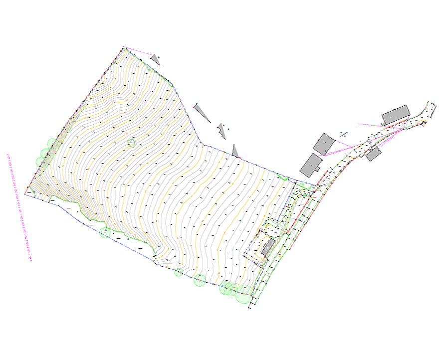
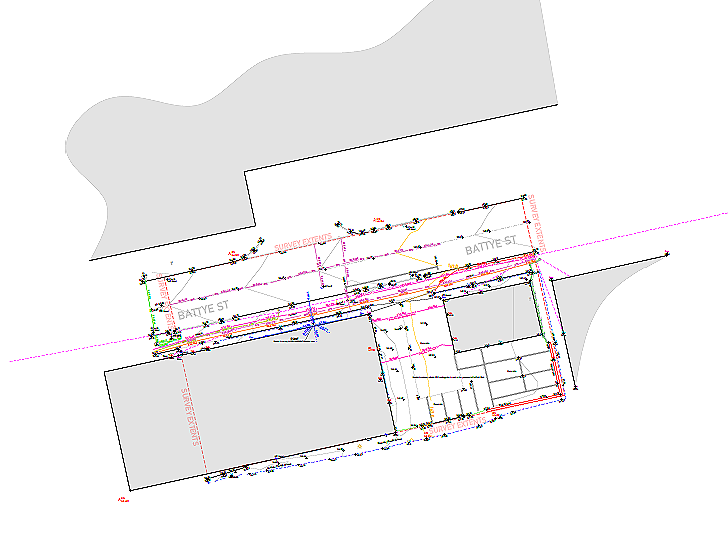
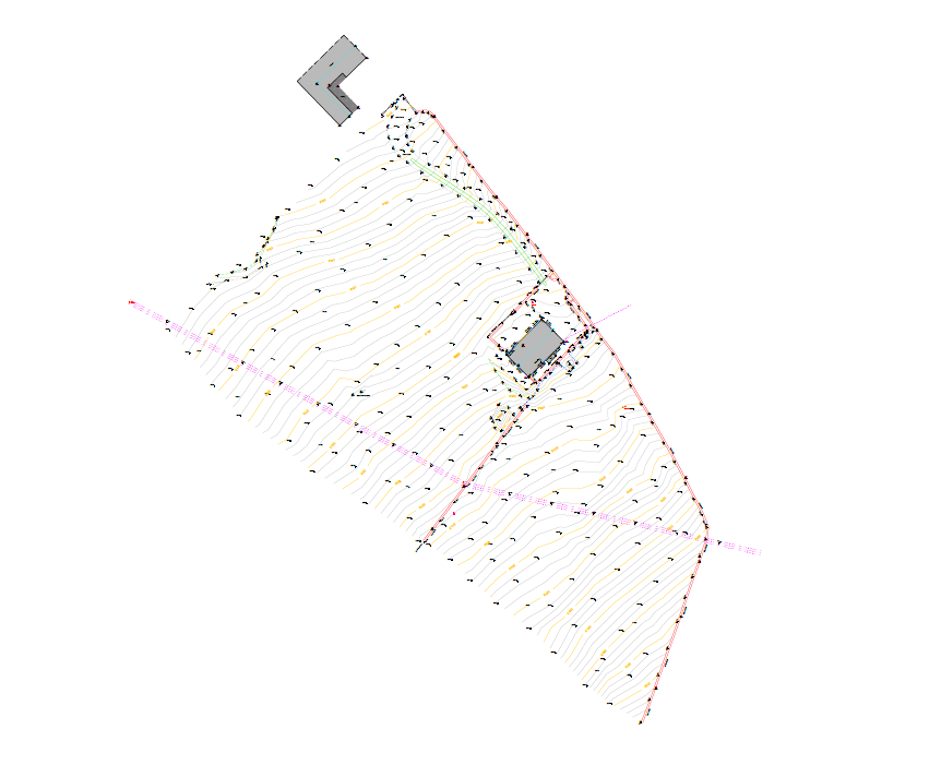
Topographic Surveys
Our topographic surveys provide a detailed and accurate representation of existing site features, levels, and boundaries across Newcastle and the North East.
Using total stations, GNSS, and 3D laser scanning technology, we capture comprehensive site data suitable for planning applications, drainage design, and civil engineering projects.
All surveys are referenced to the Ordnance Survey National Grid and delivered in clear, easy-to-use CAD or 3D formats, ready for design and construction.

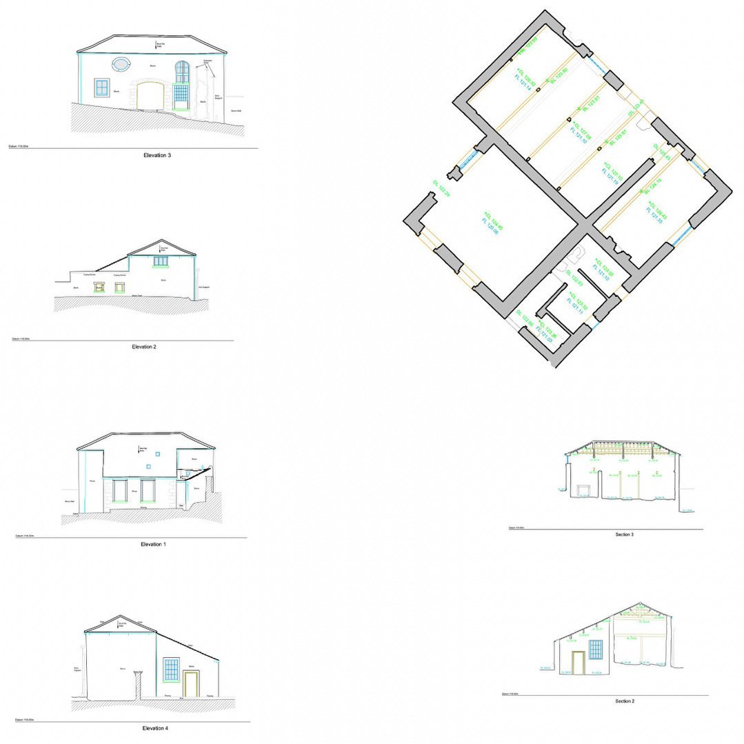
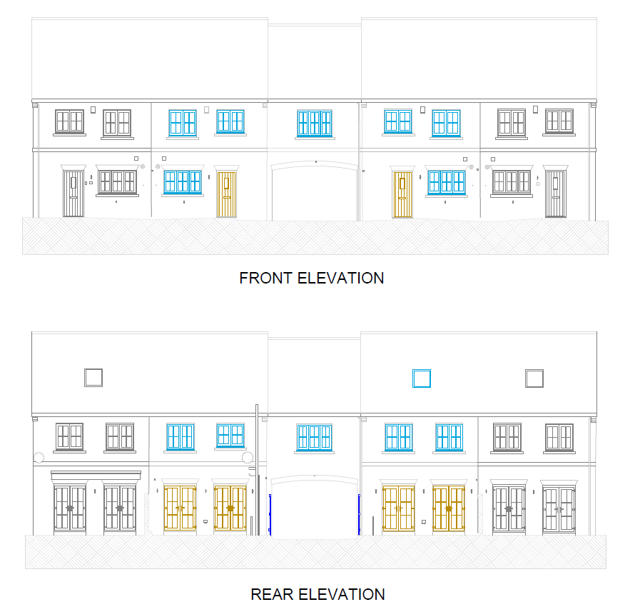
Measured Building Surveys
Brookes Geospatial LTD delivers precise measured building and topographic surveys throughout Newcastle and the North East, supporting architects, engineers, and developers with dependable spatial data.
Using laser scanners, we capture accurate building geometry for detailed floor plans, elevations, and 3D models, alongside comprehensive land surveys for planning and design.
Our focus is on accuracy, clarity, and efficiency — providing data you can trust from concept through to construction.

Setting Out
Our setting out services ensure designs are built accurately on site — from foundations and drainage to kerb lines and finished surfaces.
Working across Newcastle and the North East, we use high-precision Leica total stations and GNSS equipment to position every element exactly as specified.
We support housing developments, commercial builds, and infrastructure projects, providing clear communication and dependable results you can trust on site.

Utility Surveys
Our utility surveys accurately map underground services to help you plan and excavate safely and efficiently.
Using electromagnetic detection (EML) and ground-penetrating radar (GPR), we locate and record buried utilities including electric, water, gas, telecoms, and drainage networks.
Delivered in clear CAD formats, our surveys reduce the risk of service strikes and provide the essential data needed for design, construction, and asset management.
Recent Projects


-
![Collinson Construction]()
Always a pleasure having James on Site. A true professional providing quality work every time.
Robert Leggatt
-
![RWG Projects]()
What a credit James is. Nothing’s too much trouble. He’s always on it every time he comes to site. I’ve worked with plenty of engineers over the years and i honestly think he’s one of the best i know
Robert Gerrard
-
![ND Civils]()
James has done a lot of surveying for us always makes sure everything is perfect very professional, machine control models are excellent and always makes sure your happy before he leaves site.
Colin Pennington


Ready to discuss your next project?
For more information fill in the form or click the button below for more details.