Project / Industrial / Topographical Survey
Thermal Road.
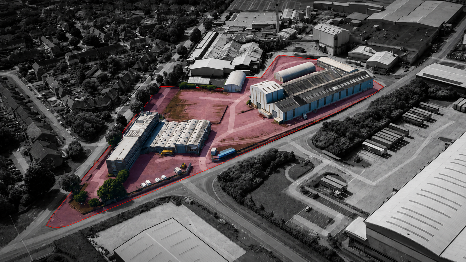
A detailed 2D and 3D topographical survey for Barnfield Construction, supporting the future development of an operational industrial site in Liverpool.
Explore the project ↓The brief
Full site information.
Ready for development.
Barnfield Construction appointed Brookes Geospatial to deliver a comprehensive 2D and 3D topographical survey of an existing industrial site at Thermal Road, Liverpool.
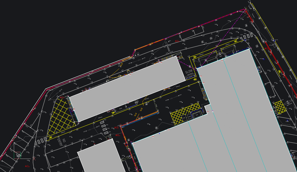
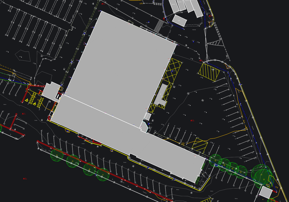
The survey was required to support the future development of the site, providing an accurate record of buildings, levels, hardstanding, parking, boundaries, access routes and surrounding features for the design team.
Following the initial survey, we were also asked to return to site to trace an oil main through the development area so that this key constraint could be incorporated into the project information.

Thermal Road — full topographical survey overview
The challenge
Operational site.
Controlled survey delivery.
The site remained operational throughout the survey, requiring careful coordination with the existing occupiers to minimise disruption.
Reliable survey control was critical across the full industrial site. We completed a 405 m closed-loop traverse using 12 stations, achieving an accuracy of approximately 1:51,000 and providing a robust framework for the survey.
The later requirement to trace an oil main added a further element to the scope, ensuring the final information reflected an important infrastructure constraint affecting future development.
How we delivered
One controlled workflow, from field capture to final issue.
Swipe through the workflow →
Survey control
A 12-station closed-loop traverse was established across the site, providing robust control for all subsequent survey work.
Topographical capture
Buildings, levels, hardstanding, access routes, parking, boundaries and surrounding features were surveyed across the operational site.
3D site survey
Three-dimensional site information was captured to support terrain understanding and future design development.
Oil main tracing
We returned to site to trace an oil main through the development area and incorporate the additional information into the survey package.
Processing & checks
Field data was processed, checked and coordinated against the project control to create a consistent 2D and 3D dataset.
Final issue
The completed topographical survey, drawings and supporting site information were issued within 10 days of instruction.
Swipe the survey drawings →
The outcome
A complete site record.
Ready for the next stage.
Barnfield Construction received a comprehensive 2D and 3D topographical survey providing a clear existing-site base for future development.
The final information combined detailed site geometry, levels, boundaries, access and parking information with the later oil-main tracing work, giving the project team a reliable dataset for design and coordination.
The fieldwork was completed over 3.5 days and the full survey package was delivered within 10 days of instruction while working around an operational industrial environment.
Client feedback
“I think this is the best topographic survey I’ve ever seen.”
Services delivered
Deliverables built around the development workflow.
The outputs were prepared as one coordinated package, giving Barnfield Construction the existing-site information required to progress design and development work.
Detailed plan information showing buildings, levels, hardstanding, access, parking, boundaries and surrounding features.
Three-dimensional survey information providing a coordinated base for terrain understanding and future design.
A 12-station closed-loop traverse providing robust control across the full industrial site.
Additional return survey work to identify and record the route of an oil main through the development area.
A clear, checked drawing package bringing the captured site information together in one consistent dataset.
Three-dimensional information prepared for direct use within the client's development and design workflow.
Site photographs supplied alongside the survey to provide additional visual context for the project team.
A complete existing-site record prepared to support the next stage of design, coordination and redevelopment.
Start a project